fsublog
Monday, April 18, 2011
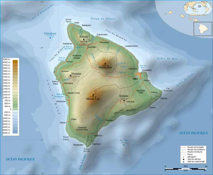
Topographic map
This is a topographical map of Hawaii by France. One can see the circles aroud the base of two mountains depicted are larger because they are closer to sea level. As the elevation of the mountains rise the circles become tighter around the top.
http://commons.wikimedia.org/wiki/File:Hawaii_Island_topographic_map-fr.svg?uselang
No comments:
Post a Comment
Newer Post
Older Post
Home
Subscribe to:
Post Comments (Atom)
No comments:
Post a Comment